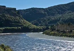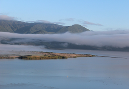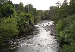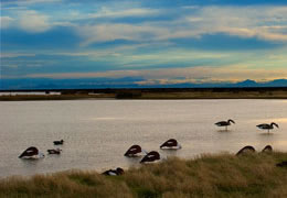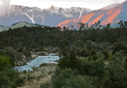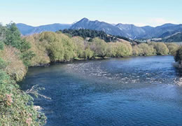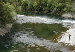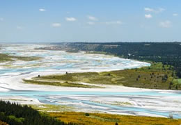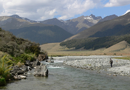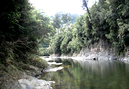
The Motu River was the first New Zealand 'wild and scenic' river to win protection from a Water Conservation Order in 1984.
The major waterway on the eastern side of the North Island rises on the southern side of the Raukumara Range, south of Opotiki, heads east and cuts its way through the range (where it receives important tributaries) and empties into the Bay of Plenty.
The Maori name Motu means cut off, isolated. This refers to the dense forests around the headwaters. This important wilderness river passes through mostly steep, uninhabited hill country with thick native bush. It is used for adventure tourism (jet-boating and white-water rafting). A mid-20th century proposal to dam the river for hydroelectricity was rejected.
The WCO says the river should be preserved as far as possible in its natural state from the Motu Falls to the SH35 bridge.
To read the full legislation document for the WCO applied to this waterway click here
The Rakaia River crosses the Canterbury Plains, one of the largest braided rivers in New Zealand.
It rises in the Southern Alps, travelling 150km in a generally east or southeast direction before reaching the sea 50km south of Christchurch.
The Rakaia River is bridged in two places; the busiest is at the small town of Rakaia, 20km from the river mouth, and the second is in the Rakaia Gorge.
The Rakaia River is a celebrated salmon fishery. The Rakaia is also known for its large wrybill population. Other important bird species known to be found in the river bed are the black-fronted tern and banded dotterel.
The Rakaia WCO was passed in 1988 but TrustPower has applied to amend parts of the order for the Lake Coleridge Project.
To read the full legislation document for the WCO applied to this waterway click here
The Grey River (Mawheranui) is located on the western side of the Southern Alps, 12km southwest of the Lewis Pass. It flows from Lake Christobel, running westward for 120 kilometres before draining into the Tasman Sea at Greymouth.
Numerous small rivers are tributaries of the Grey, and several of them drain lakes. Notable among these are the Ahaura River and the Arnold River, which is the outflow of Lake Brunner. A small hydroelectric station is located on the river 25km upstream from the mouth of the river.
The Grey River's mouth is protected by a large sandbar, Greymouth bar, which is a notorious shipping hazard. The river was given WCO protection in 1991 for an outstanding natural characteristic in the form of a meandering incised river gorge, along with outstanding scenic features.
To read the full legislation document for the WCO applied to this waterway click here
Lake Wairarapa lies at the southern end of the Wairarapa region, 50km east of Wellington. The lake is the third largest in the North Island, fractionally smaller than Lake Rotorua.
The lake's catchment area is large, and includes the eastern slopes of the Rimutaka and Tararua ranges. The lake takes water from several rivers and was originally the main outflow for the Ruamahanga.
The area around Lake Wairarapa is low-lying and swampy, and recent efforts have been made to preserve its important wetland features and restore wildlife habitat.
The lake has long been used by Maori as a source of readily available food, and many species of waterfowl and fish uncommon elsewhere can be found in or around the lake.
The WCO passed in 1989 seeks to protect the wildlife habitat on the eastern lakeshore in particular.
To read the full legislation document for the WCO applied to this waterway click here
The Manganui o te Ao River, in the centre of the North Island, has its source in numerous streams and small rivers which flow west from the slopes of Mount Ruapehu.
The main course of the river flows predominantly southwest through rugged hill country to meet with the Whanganui River 10km north of Pipiriki, at the edge of Whanganui National Park.
A WCO was passed in 1989 to protect in particular the endangered blue duck (whio) which has a preference for clean, fast-flowing streams in the forested upper catchments of New Zealand rivers.
The Manganui o te Ao River catchment is one of eight sites identified in the National Whio Recovery Plan (2007) as a priority for whio management.
To read the full legislation document for the WCO applied to this waterway click here
Lake Ellesmere (Te Waihora) is in Canterbury; in reality a broad, shallow lagoon to the west of Banks Peninsula, and separated from the sea by a long narrow sandy spit. The lake is of major historical and cultural significance to local Maori, and its Maori name Te Waihora, means spreading waters.
The lake covers an area of 198 square kilometres, and is New Zealand's fifth largest lake. Nearly all of the water entering Lake Ellesmere is derived from the groundwater system that underlies the gravel-dominated strata of the Central Canterbury Plains.
A wide range of both water and land-based activities in the area include fishing, game bird hunting, bird-watching, picnicking, camping, and cycling, and water sports such as kayaking.
A WCO was granted in 1990 to preserve its wetlands and fish, and recognise it as a habitat for wildlife, and of significance to Maori.
A 2010 report identified Lake Ellesmere as the country's second most polluted lake, but restorative programs are underway.
To read the full legislation document for the WCO applied to this waterway click here
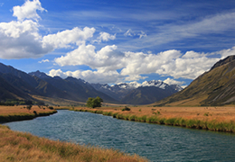
The Ahuriri River is in Otago, its headwaters on the eastern flanks of the Southern Alps. The nearest township is Omarama.
The river flows for 70km through the southernmost part of the Mackenzie Basin before reaching the Ahuriri Arm of Lake Benmore, one of the lakes in the Waitaki hydroelectric project. From there it joins with the Waitaki, flowing on to the sea.
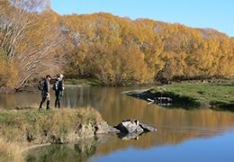
Much of the upper portion of the river is in the Ahuriri Conservation Park, and it's a well-regarded fly fishing river, containing both brown and rainbow trout.
The WCO passed in 1990 recognises the river and its tributaries as an area of outstanding wildlife habitat and fisheries, with "outstanding angling features".
To read the full legislation document for the WCO applied to this waterway click here
The Rangitikei River (not to be confused with the Rangitaiki, Bay of Plenty) is one of the country's largest, flowing through the central and northern North Island for 185km.
Its headwaters lie to the southeast of Lake Taupo in the Kaimanawa Ranges. It flows from the Central Plateau south past Taihape, Hunterville, Marton, and Bulls, to the South Taranaki Bight at Tangimoana.
The river is popular for jetboating, white water rafting, kayaking and fishing, and it has campgrounds along its banks. Its papa (clay) cliffs and deep canyons provide the perfect setting for adventure activities such as bungy jumps and flying fox rides. Part of the river featured in Peter Jackson's movie The Lord of the Rings: The Fellowship of the Ring.
The WCO passed in 1993 recognises the river's outstanding wild and scenic characteristics, recreational fisheries and wildlife features.
To read the full legislation document for the WCO applied to this waterway click here
The Kawarau River drains Lake Wakatipu Otago, flowing generally eastwards for about 60km until it passes through the steep Kawarau Gorge, and joins Lake Dunstan near the town of Cromwell. The Shotover River enters from the north; the Nevis River enters from the south.
In the 19th century, gold was extracted from the river. Some of the miners huts remain today, many of them close to thriving vineyards.
Adventure activities on the river include jet boating, white water rafting, river surfing, and bungy jumping.
A WCO protects the river and wider catchment for its wild and scenic character, natural characteristics, angling, scientific values and recreational use. No damming is allowed and the water must be maintained to a specific standard.
To read the full legislation document for the WCO applied to this waterway click here
The Mataura River in Southland is 190km long. The river's headwaters are located in mountains to the south of Lake Wakatipu. It flows southeast towards Gore, and then passes through the town of Mataura, to reach the sea at Toetoes Bay on the southern coast of the South Island.
The name comes from the Maori words mata ('red') and ura ('eddying'). The red colouring of the water is caused by iron oxides in the local swamps.
The Mataura, along with the three other main Southland rivers, breached during the Southland floods of January, 1984. Commercial and residential parts of Mataura were hit hard, including the pulp and paper plant.
The Mataura, popular with anglers, is internationally-renowned for its brown trout fishery. The WCO was passed in 1997 in recognition of "outstanding fisheries and angling amenity features".
To read the full legislation document for the WCO applied to this waterway click here
The Buller River (Kawatiri) is one the country's longest rivers, flowing for 170km from Lake Rotoiti in Nelson Lakes National Park through the Buller Gorge and into the Tasman Sea near the town of Westport.
The river is named after Charles Buller, an early MP and director of the New Zealand Company.
The Buller's source is on the northern slopes of Mount Travers in the Saint Arnaud Range. The river and its tributaries have an international reputation for brown trout in particular.
The Buller, upstream from Murchison, along with the Mangles River are popular for whitewater kayaking and angling. SH6 follows the river for much of its length.
The WCO came into force in 2001, listing the waters of the Buller River and tributaries to be retained in their natural state or protected because of outstanding wild and scenic characteristics, fisheries and habitat features, and scientific values.
To read the full legislation document for the WCO applied to this waterway click here
The Motueka River in the north of the South Island is a popular destination for water sports and trout fishing. The Motueka flows 120km from the mountains 40km west of Nelson, north to Tasman Bay near the town of the same name.
The Motueka has three major tributaries: the Motupiko River, Wangapeka River and the Baton River, as well as some smaller tributaries.
The river is well known for excellent brown trout fishing along its entire length. Large numbers of trout are found below the Wangapeka confluence, and very large trophy fish have been caught.
The river is also appreciated for rafting, canoeing or just drifting down on an inner-tube.
A Motueka River WCO came into force in 2004, in recognition of outstanding recreational, wild and scenic characteristics, along with fisheries and wildlife habitat features. The order included restrictions on damming or altering river flows to protect spawning by brown trout.
To read the full legislation document for the WCO applied to this waterway click here
The Mohaka River in northern Hawke's Bay flows east-southeast for 70km from the Ahimanawa Range, before reaching the sea near the settlement of Mohaka, 20km from the East Coast town of Wairoa.
The upper reaches and its many tributaries flow through about 20km of native bush, providing what is described as 'top quality wilderness fishing' for a good population of large, mostly brown trout.
The WCO was granted in 2004 over the Mohaka and its tributaries in recognition of this outstanding trout fishery above the SH5 bridge and in the tributaries.
The order also covers the outstanding scenic characteristics of the Mokonui and Te hoe gorges, and the river's value for water-based recreation from the bridge to Willow Flat.
New Zealand's highest railway bridge, the trestle-constructed Mohaka Viaduct on the Palmerston North - Gisborne line, crosses the Mohaka River close to the small settlement of Raupunga.
To read the full legislation document for the WCO applied to this waterway click here
The Rangitata River (Rakitata) is one of the braided rivers that helped form the Canterbury Plains. It flows southeast for 120km from the Southern Alps, entering the ocean 30km northeast of Timaru.
Before the river enters the Canterbury Plains, part of it is diverted to the Rangitata Diversion Race (RDR) for irrigation and hydroelectric power generation. It supplies water to the Montalto and Highbank schemes before joining the Rakaia River.
The river's entry point into the scheme has New Zealand's first acoustic fish fence, keeping salmon smolt in the river and preventing them ending up on farmland.
The Rangitata is the most fished river in the Central South Island Fish & Game region, with a self-sustaining Chinook salmon fishery. Anglers mainly target salmon but also fish brown trout, rainbows and brook char.
A WCO was passed in 2006 identifying the outstanding characteristics of the Rangitata River. The order lays down constraints on damming, alteration of river flow and form and water quality, and maintenance of fish passage.
The WCO recognises the economic value of the river, and provides for some existing uses including the RDR.
To read the full legislation document for the WCO applied to this waterway click here
The Oreti River in Southland is the South Island's third largest river.
It rises southwest of Lake Wakitipu and flows past the town of Mossburn on its way to the sea near the city of Invercargill.
The WCO application was made by Fish & Game councils in 2005 to protect the outstanding values and fishery and natural state of the river upstream from Mossburn.
The order, passed in 2008 recognises the brown trout habitat and angling amenity of the river and its tributaries, its black-billed gull habitat, along with the tikanga value to Maori.
To read the full legislation document for the WCO applied to this waterway click here